Discover history, experience culture, understand faith and meet the people who call Tibet home.
At Snowland Travel, we value the perspectives of people living in Tibet. We introduce you to its rich history, enduring culture and faith, and the rhythms of everyday life.
Ngari Travel Guide | Sacred Mountains, Guge and the Lakes of the Northern Route
Ngari · Sacred Mountains, Ancient Kingdoms & the Northern Lakes
Kailash, a focus of prayer; sacred lakes reflecting the sky; memories of the Guge Kingdom etched into earthen forests; and lakes and grasslands beyond the road leading north. We at Snowland Travel, a Tibetan team, introduce the nature, history and living cultural traditions of western Tibet.
Planning a Journey to Ngari
This page introduces tourism resources. Foreign nationals need to confirm permits and approved routes according to their nationality, departure period and destinations. Entry to every place shown here is not guaranteed.
Conditions differ for viewing the sacred mountain, walking a kora, visiting cave interiors, traveling near borders and driving across the northern plateau. We check roads, accommodation and seasonal opening conditions, allowing ample time for travel and rest.
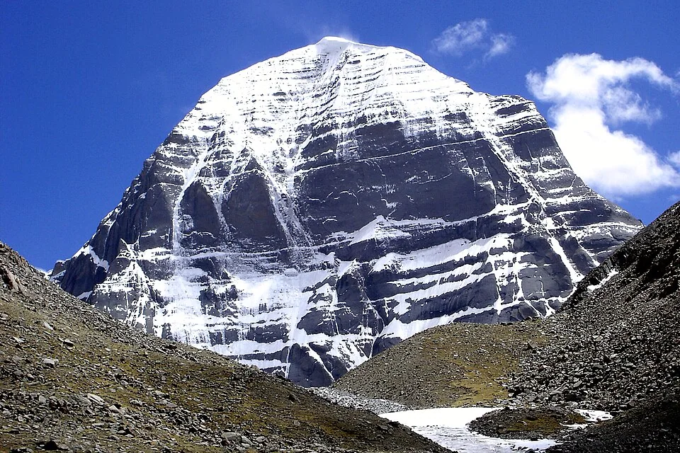
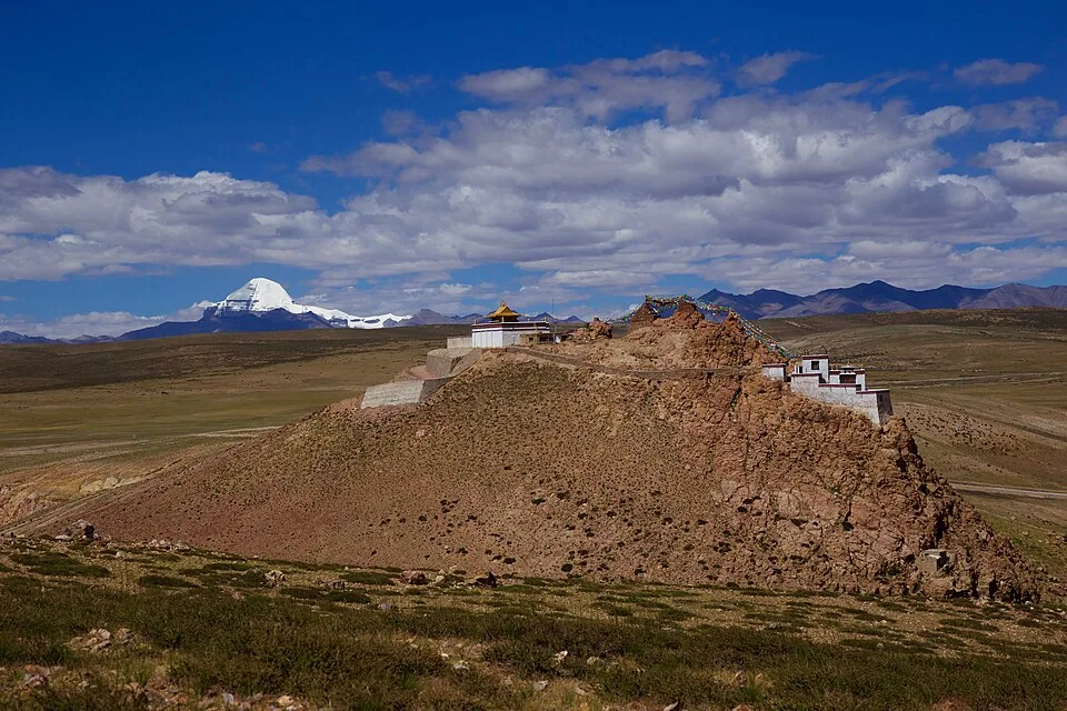
The snow-clad, four-sided form of Kailash rises quietly beneath an immense sky. Known in Tibetan as Kang Rinpoche, this sacred mountain has long been cherished by followers of Tibetan Buddhism, Bon, Hinduism and Jainism. The depth of this land is expressed both in the mountain itself and in the prayers of those who journey toward it.
A journey to enjoy the views and a kora around the mountain are different experiences. Walking the pilgrimage route requires preparation for the altitude, walking distances, mountain passes and accommodation conditions. We discuss a way to visit that suits your wishes and health, without making strenuous walking a goal in itself.
We introduce the sacred mountain as a landscape to approach with respect. Climbing to its summit is not included in our sightseeing activities.
Darchen & the Kailash Pilgrimage Circuit
Darchen & the pilgrimage circuit
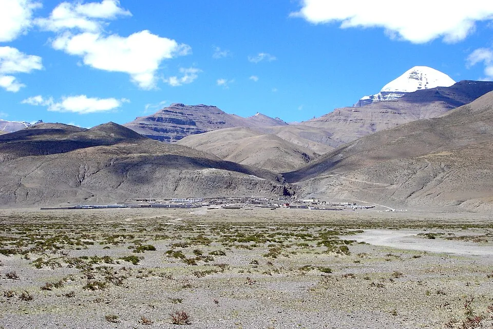
Darchen, at the southern foot of Kailash, is a base town for mountain views and pilgrimage. Preparing for the journey and taking time to gaze at the distant mountain also bring a sense of drawing closer to Ngari.
The outer pilgrimage route passes through valleys, monasteries, passes and meadows. As it involves a long walk over Dolma La, we check walkable sections and seasonal operating conditions in advance. Sections with special entry requirements, including the inner kora, are treated separately from ordinary sightseeing.
Dirapuk Monastery & North Face Views
Dirapuk Monastery and the North Face of Kailash
A monastery and valley on the northern side of the Kailash pilgrimage route. As you approach the mountain, its rock walls and streaks of snow become clearer, revealing a different face from the distant view.
A visit here is considered together with plans to walk the pilgrimage route. Even a return walk involves exertion and altitude, so arrangements depend on transport options, accommodation and your health.
Zutulpuk Monastery (Zuchu Monastery) also stands on the eastern side of the pilgrimage route. Known for traditions associated with Milarepa, it can be visited according to the scope of the kora and the monastery's opening conditions.
Lake Manasarovar
玛旁雍措
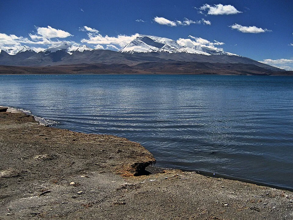
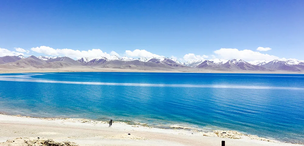
This sacred lake lies south of Kailash on high ground overlooking the snowy Himalaya. Blue water, distant ridges and prayer flags moving in the wind create a landscape in which nature and faith are inseparable.
We value time both to appreciate the lake's colors and to learn about its sacred significance. Its appearance changes with clear skies, clouds and wind; mountain reflections and morning or evening light cannot be promised.
We protect the lakeshore environment and pilgrimage practices, following local rules on access and photography. We do not plan sightseeing on the assumption of entering the lake or driving freely along its shores.
Lake Rakshastal
拉昂措
Another large lake west of Lake Manasarovar. Curving shores, stark terrain and distant snowy mountains make it rewarding to compare these two neighboring lakes.
Sometimes introduced as the “Ghost Lake,” it is a place where we distinguish local stories from the actual natural landscape, rather than focusing only on its curious name. Photography takes place at safe spots along approved roads.
Gurla Mandhata
纳木那尼峰
This great snowy mountain in the western Himalaya enriches journeys through Purang and the sacred lakes. White peaks and plateau meadows form a broad landscape different from the orderly outline of Kailash.
Ordinary sightseeing views the mountain from viewpoints near the lakes or along roads. Approaching glaciers or mountaineering requires arrangements and permits different from regular scenic viewing. If wildlife appears, we observe from a distance without pursuing it.
Chiu Monastery
Chiu Monastery (Jiwu / Qiwu)
This small monastery stands on high ground beside Lake Manasarovar and is known for its sweeping lake and mountain views. Looking up at it from the shore and looking across the water from the hill each offer a different attraction.
We introduce the culture of prayer around the sacred lake, including faith traditions associated with Padmasambhava. Before visiting, we check uphill walking, opening times, ceremonies and conditions for interior photography.
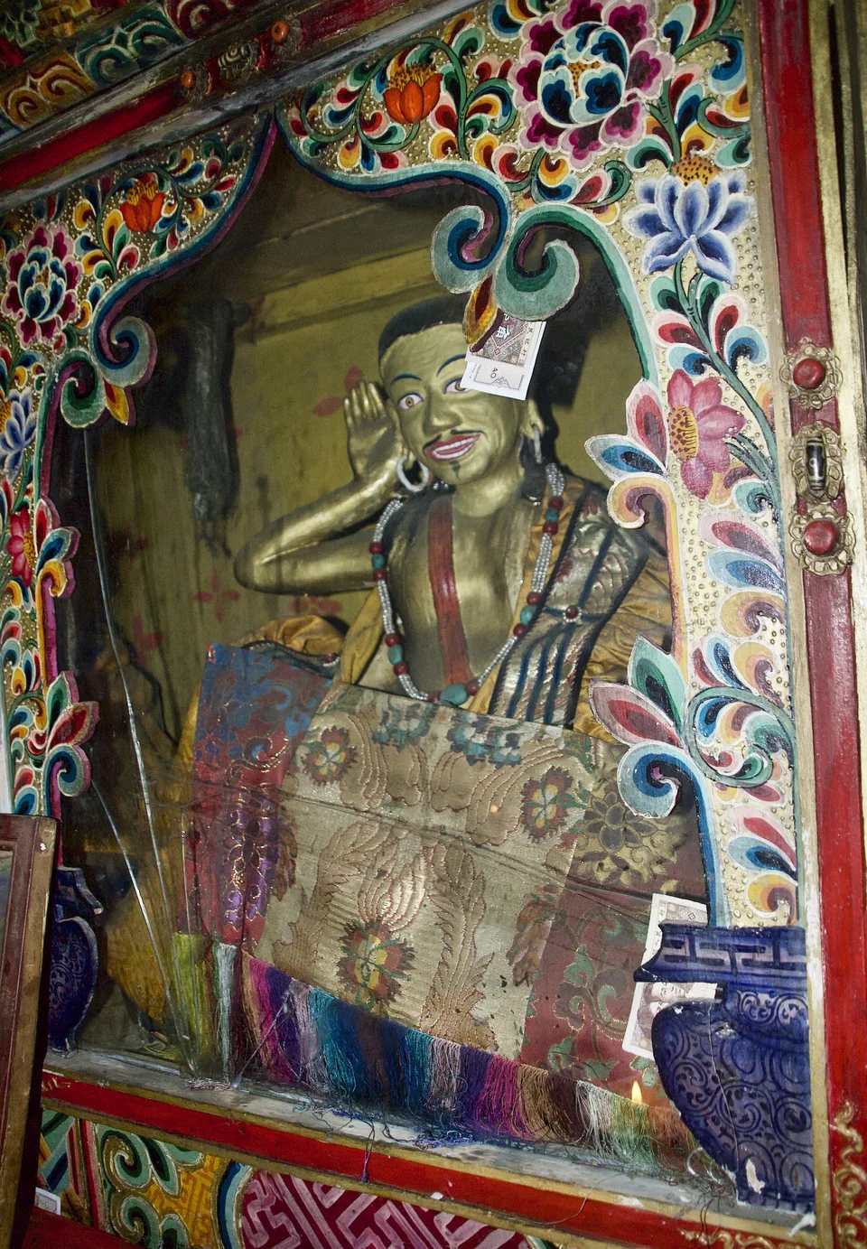
Statue of Milarepa inside Tirthapuri Monastery
Tirthapuri
Tirthapuri and Tirthapuri Monastery
Tirthapuri, in the Sutlej River basin, is a pilgrimage site combining a monastery, traditions of spiritual practice and ground where hot springs emerge. Adding it to a Kailash and sacred lake journey shows that western Tibet's sacred geography extends beyond a single mountain.
Stories of practitioners including Padmasambhava are passed down here, and the monastery and surrounding pilgrimage spaces hold memories of generations of prayer. The photograph shows a statue of Milarepa inside the monastery.
Although “hot springs” may suggest bathing facilities, we do not present this as a place where bathing or use of facilities is guaranteed. We check the accessible areas of the monastery, pilgrimage route and river valley, and visit quietly.
Guge and Zanda | Memories of a Kingdom, Caves and Earthen Forests
Guge Kingdom Ruins · Tsaparang
Guge Kingdom Ruins and Tsaparang
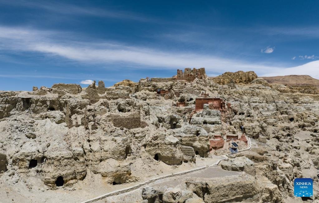
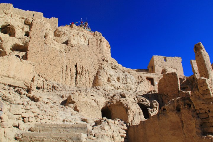
Ruins of a royal capital, with layers of palaces, temples, dwellings and caves across earth-colored slopes. The fusion of architecture and mountain forms leaves a vivid impression of the western Tibetan culture that once flourished here.
Guge saw a revival of Buddhism, translation work and exchanges with India and Kashmir. Visit the ruins with an eye not only to the kingdom's rise and fall, but also to the lives of monks, craftspeople, merchants and residents who met here.
Visits involve stairs and slopes. Access to temples and murals and permission to photograph follow conservation rules; we do not assume that every hall is open.
Tholing Monastery
托林寺
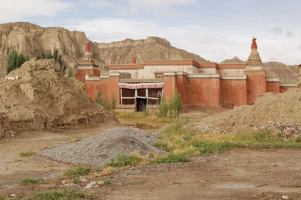
An important monastery in the history of western Tibetan Buddhism, surviving beside the Sutlej River in today's Zanda town. It developed under the patronage of the Guge royal family and preserves the learning and art of a period when Buddhism was spreading anew.
Tracing its connections with Yeshe Ö, the translator Rinchen Zangpo and the Indian master Atisha reveals cultural exchanges linking Ngari and South Asia. It is worth exploring alongside the royal ruins of Tsaparang.
The surviving buildings and murals are protected. We confirm which halls and opening hours are available; interior photography is allowed only with permission.
Dungkar Caves
东嘎遗址
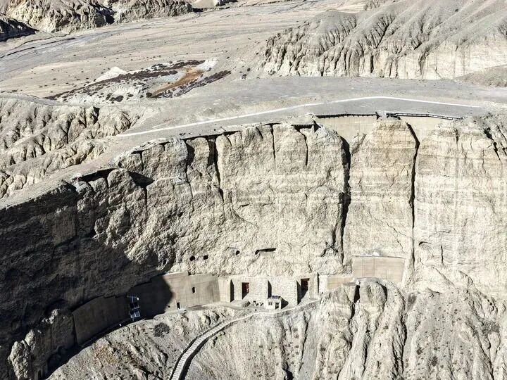
These caves cut into cliffs in the Zanda region are important remains of Guge-era faith and Buddhist art. Seeing them together with Piyang reveals a historic landscape combining monasteries, homes and community activities.
Inside the caves, images of mandalas, Buddhas, bodhisattvas and protective deities turn walls and ceilings into a single space of prayer. Red and blue colors, ceiling construction and finely detailed figures reveal artistic links between western Tibet and surrounding regions.
Corbelled corner ceilings and dome-like structures are also features to observe in caves where visits are permitted. However, the number of accessible caves and the availability of interior visits are not fixed.
Even after permits are checked in advance, entry may be restricted because of conservation work, management decisions or conditions that day. We strictly follow local instructions on photographing, lighting and touching murals.
Piyang Caves
皮央遗址
Caves, monasteries and hilltop architectural remains overlap at this site, evoking the history of the Guge cultural sphere. Although close to Dungkar, it should be understood as a distinct place: comparing their terrain and surviving remains deepens the experience.
Built and expanded over many years, these caves preserve memories of local life and exchange as well as Buddhist practice. Comparisons with Buddhist art in Ladakh and Spiti place the journey within the cultural networks of the western Himalaya.
We introduce the ruins as places where people lived. We check accessible caves, murals and climbing limits both beforehand and on the day, and do not guarantee interior access or photography.
Zanda Earth Forest
札达土林
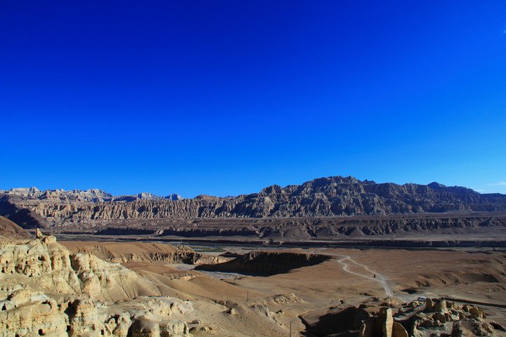
A landscape shaped from the earth itself: deeply incised plateaus form towers and rampart-like shapes. From afar, countless ridges overlap; up close, layers of sediment and fine details of erosion emerge.
The Guge ruins built into this terrain are another highlight. Low morning and evening light deepens the shadows, but we choose safe viewpoints rather than entering unstable cliffs for photographs.
Related Landscape of the Zanda Earthen Forest
Xiayigou’s Colorful Earth Forest
霞义沟五彩土林
Within Zanda's earthen forests, this is a place to appreciate colorful strata and distinctive forms. Comparing overlapping rock towers and valleys reveals the rich variety of Ngari's terrain.
The image shows a related landscape in the Zanda Earthen Forest. An actual visit to Xiayigou is considered after checking roads, scenic-area opening and approval conditions for foreign travelers. We observe without climbing the strata or touching fragile formations.
Gar and Rutog | Towns and Border Landscapes
Shiquanhe · Senge Khabab
狮泉河镇
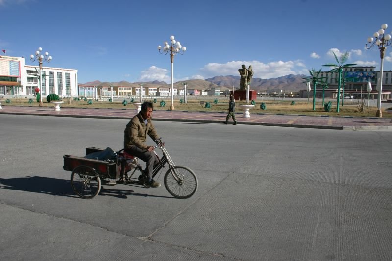
This town is a base for exploring Ngari. Beyond distant sacred sites and ruins, walking past shops, rivers and streets offers a glimpse of everyday life on the western plateau.
It is also important to rest and replenish supplies between long drives in preparation for the next destination. If you wish to visit local museums or exhibition facilities, we check opening and admission conditions.
Pangong Tso · Eastern Shore
班公湖
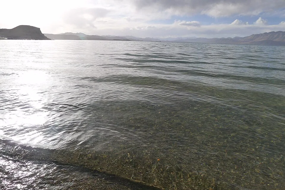
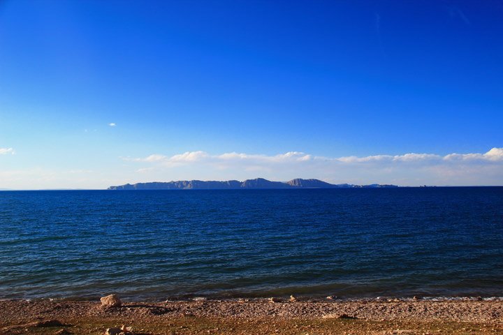
A characteristic Rutog landscape, with a long, narrow lake between mountains beneath an expansive sky. Wind, clouds and light change the water's colors, creating a beautiful contrast with the dry mountainsides.
As this is a border-related area with reported restrictions for foreign nationals, we do not guarantee it as a regular destination. We check each proposed visit separately, keeping tourism information for the Chinese and Indian sides distinct. The photograph shows the eastern shore.
Ngari Northern Route | Lake Basins, Grasslands and Snowy Mountains
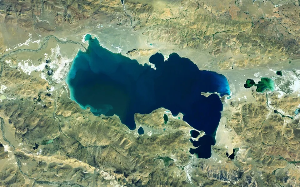
Satellite Image of Zhari Nam Tso
Zhari Namco
扎日南木措
A great lake emblematic of travel around Coqen. Its expansive basin, distant mountain outlines and sky-reflecting waters convey the scale unique to northern Ngari. Rather than rushing between sights, this is a place to feel the vastness of the land from a single viewpoint.
The image is a satellite view showing the lake's shape and surrounding terrain. We check local viewpoints, lakeshore access roads and permit conditions for foreign travelers, and do not drive onto wetlands or pastures without authorization.
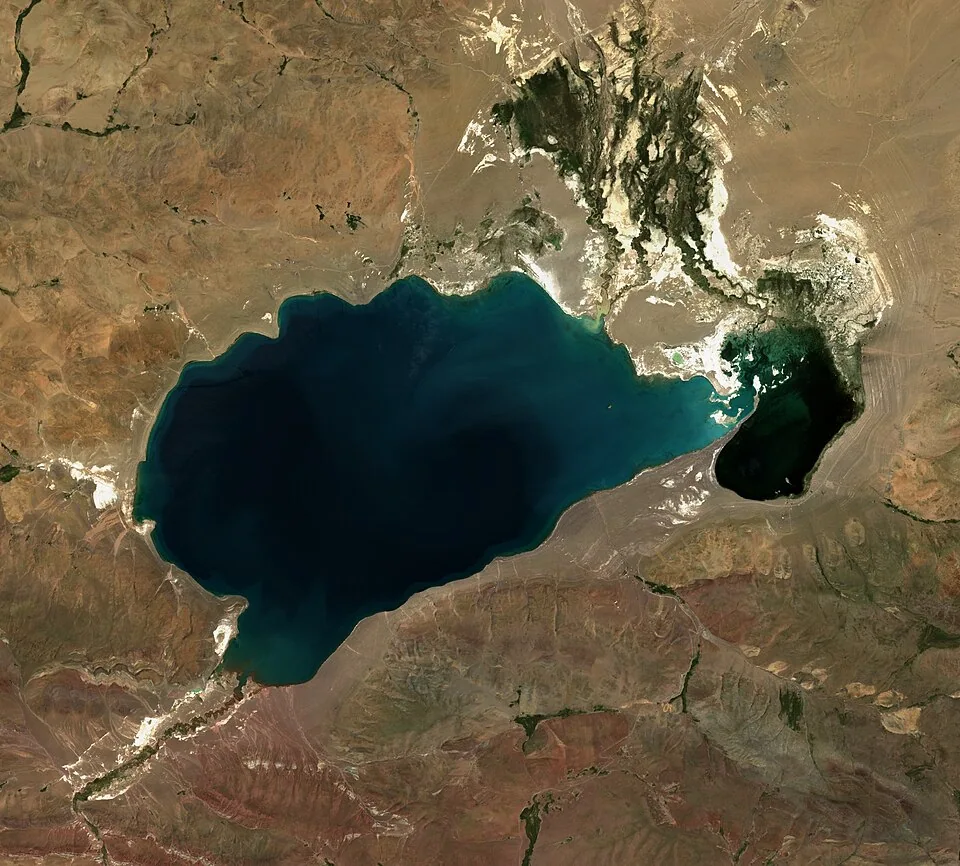
Satellite Image of Dawa Tso
Dawa Co
达瓦错
This lake comes into view on the map when planning a journey through the lake basins around Coqen. Comparing several lakes reveals differences in water color, shores and surrounding mountain forms.
The image is a satellite view illustrating the terrain. The “Northern Route” is not one fixed road; the lakes passed depend on the itinerary. A visit to Dawa Tso is also considered according to the approved route and road conditions.
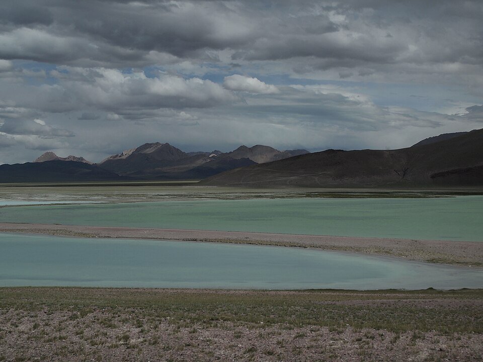
Wuma Lake & Gêrzê Lake Basins
Wuma Tso & Gerze lake region
A northern plateau landscape with long open spaces between lakes and mountains. The stillness of sky colors, water and dry slopes reveals a different side of Ngari from its sacred mountain and royal ruins.
Travel toward Gerze involves long drives and overnight stays at high altitude. We do not casually add side roads to reach lakeshores, and enjoy the scenery from permitted routes. The photograph shows Lake Wuma.
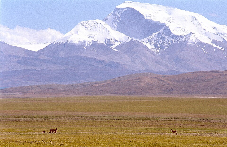
Snowy mountains and wild asses in southern Ngari. This photograph does not show a specific point on the Northern Route.
Changtang Grasslands & Wildlife
Changthang Grasslands and Plateau Wildlife
On plateau roads through distant ridges, grasslands and lake basins, rich scenery lies between destinations as well. We value time to watch changing skies and notice pastoral life and the distance we keep from wildlife.
Wildlife sightings and species cannot be guaranteed. We do not pursue animals by vehicle, feed them or enter areas outside reserve management arrangements; we observe quietly from roads open to traffic. The photograph is a related landscape of snowy mountains and wild asses in southern Ngari.
Extend toward Nagqu | Lakes and Culture beyond Ngari
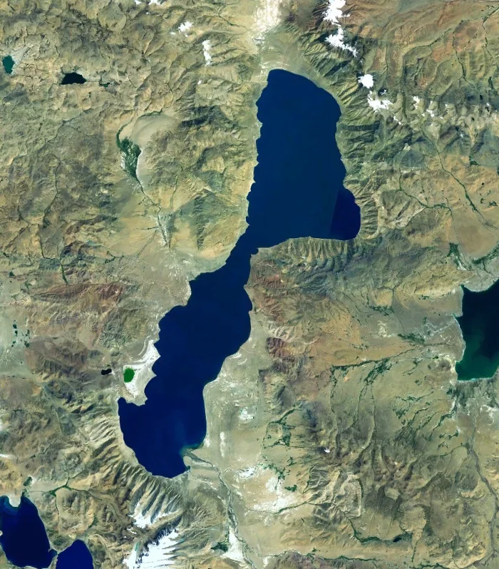
Satellite Image of Tangra Yum Tso
Tangra Yumco
当惹雍措|那曲市尼玛县
This sacred lake connects the villages, mountains and waters of the Wenbu region and has deep ties to Bon faith. It may be considered on journeys from Ngari toward Nagqu, but administratively it lies in Nagqu City rather than Ngari.
Visiting lakeside villages and traveling around the whole lake are considered separately. We respect residents' lives and beliefs and follow approved routes and local reception conditions. The image is a satellite view of the lake.
Related Satellite Image of Tangra Yum Tso
Tangchung Tso & Wenbu Village
Tangchung Tso and Wenbu | Nyima County, Nagqu City
The lakes and villages near northern Wenbu, together with Tangra Yum Tso, offer insight into Zhangzhung culture and the land of Bon. Visits to stone houses, farmland and monasteries are considered according to local reception and permit conditions.
The image is a related view showing the geographical relationship with neighboring Tangra Yum Tso, not a photograph of Tangchung Tso itself. We distinguish the two lakes and introduce them according to the itinerary.
Siling Co
色林措|那曲市
A large plateau lake where sky, water and low ridges stretch into the distance. Watching the water's colors and the wind reveals a landscape different from the lakes around the sacred mountain.
This is a possible extension from Ngari toward Nagqu, and is not included in every Northern Route itinerary. We check protected areas and lakeshore management, and enjoy nature from safe viewpoints.
Namtso Lake
Namtso | Toward Lhasa and Nagqu
Depending on the return route toward Lhasa or Nagqu, this sacred lake can be added at the end. Blue water and snowy mountains bring a quiet close to a long plateau journey.
This lake is outside Ngari. We distinguish tourist sites south of Namtso from special destinations such as the northern shore, and check seasonal road conditions and the scope of approvals for foreign travelers.
Buddhist Art of the Western Himalaya through the Guge Kingdom
Guge's history in western Tibet combines Buddhist revival with the movement of knowledge across regions. Under royal patronage, the translator Rinchen Zangpo brought in learning and art from India and Kashmir, providing context for understanding the monasteries and murals.
Atisha's work in the 11th century led to the later development of the Kadam tradition. The teachings passed down from it also influenced Tibetan Buddhism in subsequent centuries. Connecting kingdom, translation and teacher-disciple traditions reveals the ruins as meeting points in a wider cultural world.
Comparing the architecture and murals of Tholing, Tsaparang, Dungkar and Piyang also appeals to those interested in western Himalayan Buddhist art at Alchi in Ladakh or Tabo in Spiti. Some dates and origins remain debated in scholarship, so we distinguish traditions from verifiable historical facts.
Other Ruins, Monasteries and Northern Route Landscapes
Khyunglung Silver Castle | Qionglong Silver Castle and Qulong Ruins
Ruins in the Sutlej basin associated with Zhangzhung culture. The identification of ancient centers remains debated; we distinguish traditional accounts from archaeological findings.
Gurugyam Monastery
A possible stop for exploring Bon culture in the Sutlej basin. We check monastery reception, visitable areas and entry requirements for foreign travelers.
Khojarnath Monastery
A monastery in Purang known for history associated with the translator Rinchen Zangpo. We check border-area travel conditions, ceremonies and opening arrangements in advance.
Daba Ruins and Marang Earthen Forest
Possible stops connecting historic travel routes and earthen forest scenery. They may lie off the usual route to Zanda, so roads and permit requirements are checked individually.
Five-Color Mountain and Namru Hot Springs
Landscapes revealing differently colored strata and plateau geothermal activity. Hot spring facility operation and bathing are checked separately and cannot be guaranteed.
Rutog Dzong and Rock Art
Historic resources for considering plateau activities such as hunting and herding. We check border-area restrictions and respect rock-art locations and protected boundaries.
Ngari Dark Sky Park and Stargazing
An opportunity to observe the plateau night sky. Visibility depends on weather, moonlight and facility opening and access conditions; views of the Milky Way and use of observation equipment cannot be promised.
Mami Tso, Dong Tso and Zangcang Chaka
Lakes and salt lakes that may be considered on the Northern Route and its branches. We do not turn a lake list directly into an itinerary: locations, lakeshore management, roads and approved routes are checked on the map.
Xia Gangjiang Snow Mountain and the Aru Mountains
Snowy mountain and glacier landscapes on the northern plateau. We distinguish views from ordinary roads from entry into glaciers and protected areas. Approaching the mountain foothills is not assumed.
Rinchen Shubtso and Zabuye Chaka
Lakes and salt lakes that may fit the southern part of a grand circuit or a central-route itinerary, located on the Shigatse side. We distinguish them from places within Ngari and check visit requirements for foreign travelers.
Northern and Southern Wenbu Villages and Dargo Snow Mountain
A cultural landscape in Nyima County, Nagqu City, linking Tangra Yum Tso and Tangchung Tso. Visits to settlements, farmland and monasteries follow local reception conditions and approved routes.
The meanings of “Ngari Northern Route,” “Central Route” and “Grand Circuit” vary by travel company and itinerary. Rather than visiting every lake in one trip, we choose destinations according to available days, health and permitted roads.
Snowland Travel
We are a locally based travel company run by Tibetans. We value not only the beauty of mountains and lakes, but also the prayers, historical memories and continuing daily lives connected with them.
Time to wait for a photograph, trace history at ruins and rest between long drives. We discuss ways to visit that match your interests and help make your Ngari journey memorable.
Compassion in our hearts, culture in our souls, history at our roots.
Land of Snow · Journeys of the Heart
Journeys through this region
Explore itineraries that visit this region, then compare trip lengths and places you would like to see.
Prices are reference amounts per person, not confirmed departures or availability. Request a quotation for your dates, party size, stays and included services.

 Lake Manasarovar
 Guge Kingdom